Coronado National Memorial

On the second morning of our trip, we headed out early after our stay in Sierra Vista. Coronado National Memorial is about a 20 or so minute drive south of Sierra Vista. This area is heavily patrolled by the local sheriffs and Border Patrol, so be sure to obey the speed limit. I really enjoyed learning about the history of the site. When Coronado and his conquistadors originally headed north from Mexico, they crossed into what is now the United States through this area. It’s really cool to explore an area with such interesting history. And it’s still an active portion of the US-Mexican border.

Address and Location
You’ll find Coronado National Memorial at 4101 East Montezuma Canyon Drive in Hereford, Arizona. Sierra Vista is also the closest town to the site.

Cost
Exploring the site is free.

What to Do
Stop at the Visitor’s Center first. It sits a few miles past the park entrance. They have some exhibits with artifacts recovered in the park, history about the indigenous settlements, and information about the Spanish expeditions. And be sure to grab a park map. You have to drive through the park to get to most of the hiking trails and other sites, so the map will keep you heading the right way.

We opted to hike the route to the Coronado Cave. This trail is about a half mile each way and gains about 500 feet in elevation. It’s not really a trail and is very narrow, rocky, and uneven. You also have to climb steps for the last 100 or so yards. At the top, you can find the cave entrance. You can also enter the cave and explore it (you’ll want to bring a flashlight or a head lamp). On the way up and down, take in the amazing views of the area.

From there, we drove to the Montezuma Pass overlook on the top of Coronado Peak. This is a real mountain road with lots of switchbacks and a steep uphill grade. The pavement ends, and the last few miles are gravel. I would recommend driving a car with good tires that can handle hairpin turns. I saw some sedans at the top of the mountain, but I used the four-wheel drive on my Jeep. You’ll be rewarded with a view of the border and the area through which the Coronado expedition traveled.

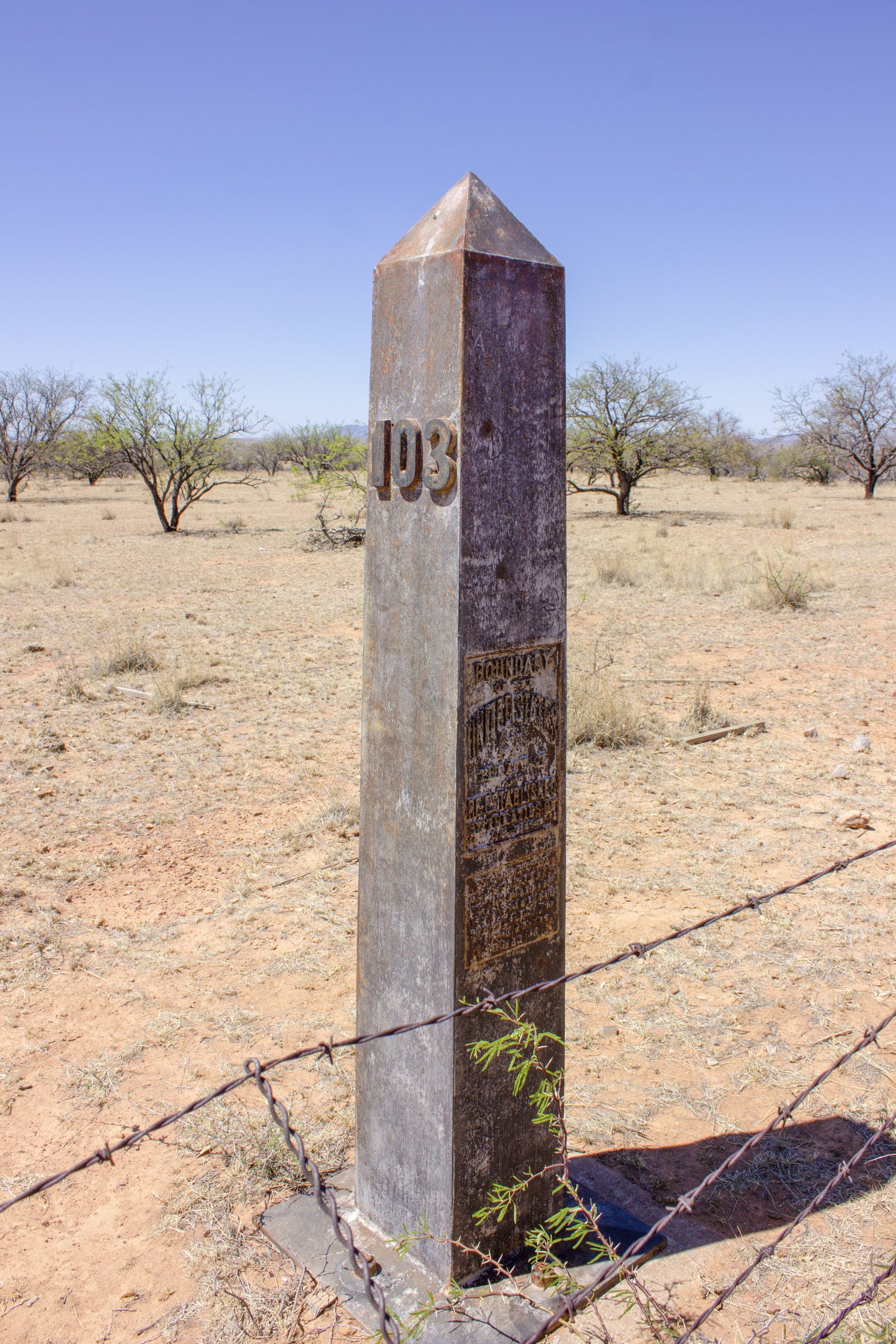
You can actually see three of the original American-Mexican stone border markers in the park. Ask for a map and directions to the markers at the Visitor’s Center. If you’re feeling really adventurous, head down the other side of Coronado Peak to find Marker 103 (Marker 102 is inaccessible because of construction). The marker is about three miles from the peak and sits on the Mexico side of the border behind two rows of fencing. You definitely need to have a vehicle with good clearance and four-wheel drive as this route isn’t really a road. Keep in mind that you will have very limited cell service (our phones thought we were in Mexico) and that you are also miles away from help in the park.

Arizona National Park Service Sites: Fort Bowie National Historic Site | Chiricahua National Monument | Coronado National Memorial | Tumacacori National Historic Site | Saguaro National Park


